Showing posts with label Snowdonia. Show all posts

Sunday, 14 August 2022

Yr Eifl

As I was in the area and the weather was superb, I decided to follow up on my loose plan to tick another TRAIL 100 summit after the day’s earlier walk to claim Moel Ysgyfarnogod.  Yr Eifl had been in view for most of the day so far so I drove over to the north coast of the Lleyn Peninsula.

The car park above Llithfaen is high enough to considerably lessen the amount of ascent; a welcome bonus after my earlier walk and in the continuing heat and sunshine.  The way up is quite simple – cross the road, start walking on the path heading east and follow it as it makes a beeline for the top!

The path is pretty good low down but deteriorates due to erosion as it steepens through the heather.  If this is your first exercise of the day, the summit will soon be reached.  But it did feel like a bit of a tiring plod in the heat and after my earlier day’s walk in the Rhinogs.

Snowdon and northern Snowdonia from Yr Eifl summit

the Rhinogydd from Yr Eifl

The views from the summit make it worthwhile though.  The haar was rolling in from the Irish Sea further down the peninsula but much of Snowdonia was in view, albeit from an unfamiliar angle.  The trig point has a metal figure 4 cemented to the top and I’ve never before seen such a summit adornment.  For an extended walk, Tre’r Ceiri and Yr Eifl’s north summit would add some archaeological exploration but at this point I was knackered I didn’t need to go to them to claim the summit tick that I was aiming for.  Perhaps a more relaxed day in the future will see me walk the fuller round.

The descent, although significantly quicker than the ascent, was tiring.  A long day in the heat is sapping and I was more than happy to get back to the car, rehydrate and head for home. 

The Northernmost Rhinogs

The MWIS forecast said “Very warm, beware sunburn.”  It wasn’t wrong!

Parking lower down from the lane end at Afon Eisengrug the walk up the road was a proper warm-up.  But turning off the road on to the track that accessed the high llyns eased the gradient and it was a pleasant stroll to Llyn Eiddew-bach where I enjoyed a welcome break watching a fisherman on the far side enjoying the landscape in a more relaxed way than I.

path under the manganese mines crags

Less than a kilometre’s walk uphill and I turned off on to a fairly level track south-east, past abandoned manganese mines and some attractive crags that looked like they would be worthwhile to climb.  The path was amongst the best single kilometres that I have walked anywhere, with superb views over Tremadoc Bay to the Lleyn Peninsula.

At Llyn Du the path curves around to the left and some easy scrambling leads to the south top of Moel Ysgyfarnogod.  This was the first point of the day from where extensive 360-degree views could be enjoyed and it was a challenge to identify the many mountains that could be seen.

Moel Ysgyfarnogod summit

The way to Moel Ysgyfarnogod looked deceivingly far but not particularly challenging.  I dropped to the low point and started up the steep grassy slope, finding a path that made progress easier.  The summit was topped and an even better panorama opened up.

Foel Penolau from Moel Ysgyfarnogod

A had a good chat with a couple of local lads, agreeing that being here in such good conditions was better than being on what would probably be an overly crowded Snowdon.  We each another well as they headed off downhill and I stayed for a while longer to enjoy the view; the Lleyn Peninsula, Yr Eifl, Portmeirion, the Nantlle ridge, Snowdon, Arenigs Fach & Fawr, Lake Trawsfynydd, Dduallt, Rhobell Fawr, the Aran ridge, the southern Arans, Cadair Idris with its Cyfrwy Arete and finally the bulk of Rhinog Fawr.

Moel Ysgyfarnogod from Foel Penolau

I walked under the crags of Foel Penolau and curved around to the north-west to the south-west top.  The true highpoint is not definitively known as the north-east top appears to be exactly the same height.  Of course I ticked both!

Trawsfynydd from Foel Penolau

big sky over the Arans

Yr Eifl from Foel Penolau

Snowdon from Foel Penolau

I walked off the north-west crags and over the northern crags of Moel Ysgyfarnogod before crossing the higher ground above and to the south of Llyn Dywarchen.  Dropping down to the footpath led back to Llyn Eiddew-bach for a well-deserved breather before the walk under the beating sun back to the car.


Monday, 27 January 2020

Idris' Chair

Considered one of the finest mountains of the principality, Cader Idris is one of the “Welsh 3 Peaks” and its location in the south of Snowdonia National Park thankfully limits its popularity.

Craig Cwm Amarch

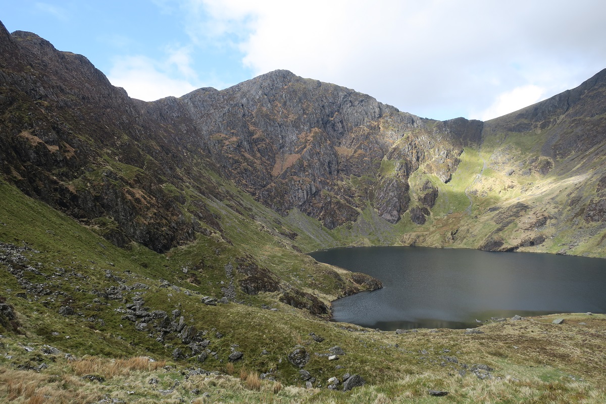
Starting from Minfford we soon passed the café and followed the pitched path up through the woods, quickly gaining height.  As we left the arboreal, we turned towards more open terrain and the amphitheatre of Cwm Cau.  The classic view of Cader now reveals itself, with the pyramid of Craig Cwm Amarch taking centre stage.  Many will look upon this and think it is the summit but the true highpoint lies just beyond the top of what you can see of the more rounded mass to the right which, despite its stature, doesn’t have as much merit as a view.

Penygadair - Cader Idris

Ascending the ridge, the path passes just below the ex-Nuttall of Craig Lwyd – a top for only the keenest baggers – and continues unerringly to the summit of Craig Cwm Amarch.  It’s an obvious summit with expansive views, especially down into the cwm.  The same can’t be said for another subsidiary summit – Mynydd Pencoed – yet another ex-Nuttall, but the tramp out to it isn’t unpleasant and provides a contrast to complement the rocky way up to the top of Cader.

Cwm Cau

At the top, two walkers had firmly claimed their seat at the base of the trig point, on the phone to friends boasting of their mountaineering achievement.  It was just about impossible to take any photo that would include the trig point without including the couple; such hogging of summits is something that I regard as contrary to considerate hill etiquette.

Following my diversion to Mynydd Pencoed I caught up with my companions at the summit shelter.  It was roomier than I thought it would be although it was missing a door at the entrance.  One hardy soul had taken up temporary residence and stayed through the previous night but despite the legend there were no apparent signs of madness or poeticism.

Summit shelter

The mile along the ridge to Mynydd Moel is a promenade as attractive as any other that I’ve walked.  It is from this summit that most decide to head downhill on a beeline back to Minfford but continuing along the ridge to its terminus at Gau Graig affords a solitudinous stroll, with the intervening Mynydd Gwerngraig completing a hat-trick of ex-Nuttall summits.  From the final top it is easy to decide to follow the fenceline that is marked on the map because it appears to lead to Bwlch Llyn Bach; but beware – it drops straight over a crag.  Such are the perils of using out-of-date Ordnance Survey maps that don’t show the footpath!

Cader Idris from the Mynydd Moel ridge

After the trudge back to the car we wandered back to the café to refuel with cake.

I slept most of the way home and although the day didn’t feel too strenuous at the time, my legs disagreed with that assumption for most of the next day.

Thursday, 22 December 2016

The Welsh Matterhorn

There are many areas that claim a mountain or hill is their “Matterhorn” and Wales is no exception.  My one and only previous visit to Cnicht was 12 years ago and before I was actively ticking the Nuttalls.  I’d reached the summit on a misty day and there was a chance that I had also bagged the north top but as I hadn’t logged it, I may not have done.  But it gave me a good excuse to revisit this fine mountain.

Moel Hebog and the Nantlle Ridge

From Croesor it looks steep and intimidating, not unlike the Matterhorn, but in reality the ridge affords an fairly easy walk as the view is a classic example of foreshortening.  Easy to navigate and easy underfoot, only the top section of the route offers a change in character with some scrambling to reach the summit.  There were quite a few family parties enjoying a taste of adventure but the shoulders of mums and dads were being used to carry the toddlers !

At the small plateau below the scramble we saw a family with three small boys descending the face to the left of the normal route.  It looked a bit hairy so I kept myself ready to help just in case they needed it – luckily they didn’t.  At the same time a fellrunner took a direct line up the face and made it look easy !

From the summit we headed over to the north top.  As we got nearer it became clear that the path skirts the top and it was obvious that I hadn’t been to it on my previous visit.  A short detour bagged the summit and we walked to the top of Cwm-y-foel, dropping down beyond the few snow patches into the hanging valley to find a suitable spot for lunch.

Tremadoc Bay from Cwm-y-foel

The walk along the edge of the dammed tarn led to the descent into Cwm Croesor and an easy walk back to the car, ending an enjoyable day out in one of Snowdonia’s less popular corners.


Cnicht from Cwm Croesor